Product Description:
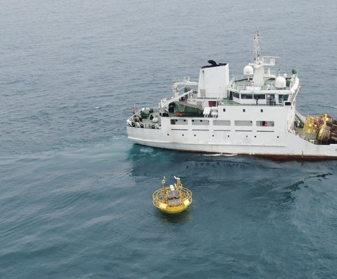
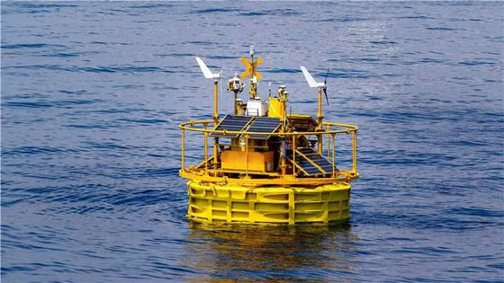
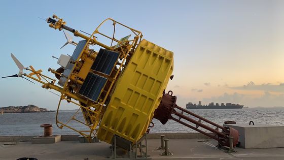
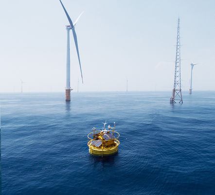
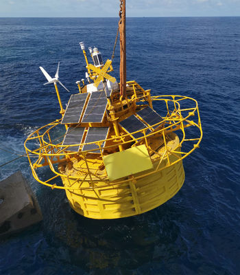
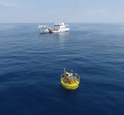
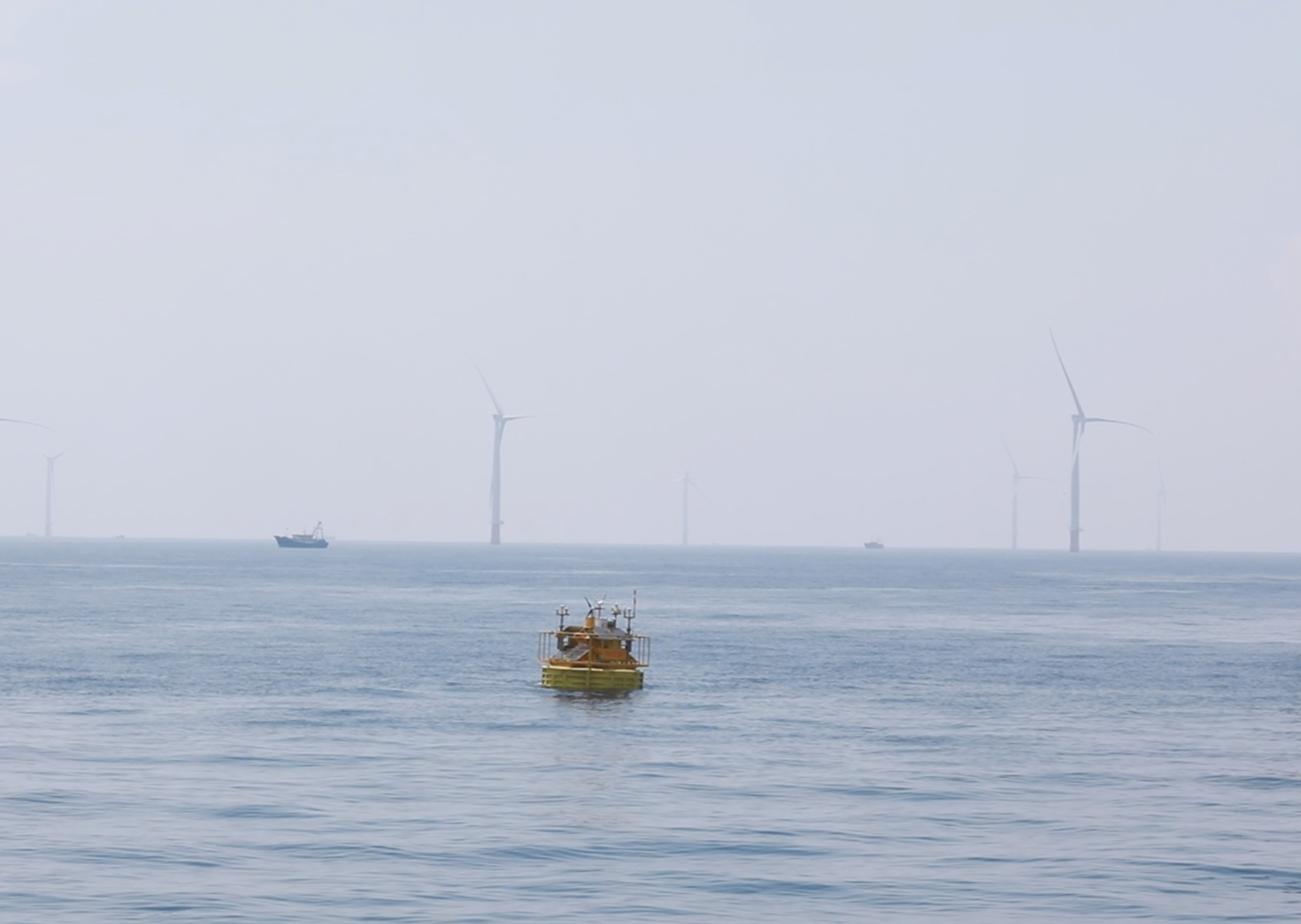
The Floating LiDAR System is a powerful Laser Scanner Detection System, also known as an Aerial Light Detection System or Light Detection and Ranging System. The system is designed to provide accurate and reliable data from a wide 360° scanning range. A DC 24V power supply powers it and can store up to 900GB of data. The system has a 10-year lifespan and can export data in TXT, CSV, and Log formats. This system is perfect for the pre-verification of Wind Farm. The Floating LiDAR System is the perfect solution for any professional looking for a precise and dependable LiDAR system.
Features:
- Product Name: BA-FLS-NX5
- Aerial Laser Mapping System
- Airborne Laser Rangefinder System
- Floating Laser Detection System
- Data Storage: 900GB
- Data Output: Quasi-Real-time
- Accuracy: 0.2m/s(0-10m/s),±2%(>10m/s)
- Lifespan: 10 Years
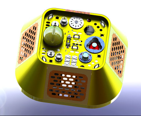
Technical Parameters:
| Product Name |
BA-FLS-NX5 |
| Aerial Laser Mapping System |
Light Detection and Ranging System |
| Scanning Frequency |
1Hz |
| Scanning Range |
360° |
| Height |
9m |
| Width |
5m |
| Weight |
15t |
| Power Supply |
DC 24V |
| Operating Temperature |
-30℃~50℃ |
| Data Format |
TXT/CSV/Log |
| Accuracy |
0.2m/s(0-10m/s),±2%(>10m/s) |
Applications:
Blue Aspirations BA-FLS-NX5 Floating LiDAR System is an innovative airborne laser rangefinder system developed in China. It has been certified as a reliable and accurate Light Detection and Ranging system and has a minimum order quantity of 1. The price of the system is 1500000-1700000 USD and it comes with a data format of TXT/CSV/Log. Furthermore, the system has a scanning range of 360° with ±2 cm accuracy. It also has a scanning frequency of 1 Hz and a data storage capacity of 900GB. This advanced Floating Laser Detection system is ideal for various applications such as 3D mapping, terrain surveying, and urban planning. It can also detect large objects, measure vegetation heights, and capture precise topographical information.
Customization:
Blue Aspirations Floating LiDAR System
- Brand Name: Blue Aspirations
- Model Number: BA-FLS-NX5
- Place of Origin: China
- Certification: 1
- Minimum Order Quantity: 1
- Price: 1500000-1700000 USD
- Lifespan: 10 Years
- Data Output: Quasi-Real-time
- Data Storage: 900GB
- Product Name: BA-FLS-NX5
- Scanning Frequency: 1Hz
Our Blue Aspirations Floating LiDAR System (BA-FLS-NX5) is an aerial light detection system designed for laser scanner detection. It offers a quasi-real-time data output and has a 900GB storage capacity. With a lifespan of 10 years and a scanning frequency of 1Hz, this system is an ideal choice for those looking for an accurate and reliable detection system. It is certified and comes with a minimum order quantity of 1.
Support and Services:
Floating LiDAR System Technical Support and Services
At XYZ, we provide technical support and services for our Floating LiDAR System to ensure our customers are satisfied with the product and have the best experience possible. Our technical support and services include:
- 24/7 customer service hotline
- Online technical support from our experienced professionals
- On-site technical support for installation and maintenance
- Regular updates to ensure customers have the latest version of the product
- Free technical training for all customers
We take pride in providing the highest quality technical support and services for our Floating LiDAR System. If you have any questions or concerns, please contact us, and one of our dedicated professionals will be happy to assist you.
Packing and Shipping:
Packaging and Shipping
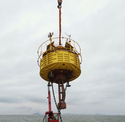
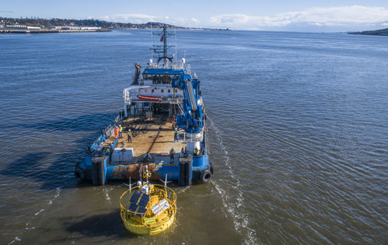
The Floating LiDAR System is carefully packaged to protect it from damage during shipping or storage. It is packaged in reinforced cardboard boxes and lined with foam padding for shock protection.
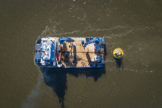
The Floating LiDAR System is shipped by air or sea freight, depending on the customer's preference. Air freight is faster but more expensive, while sea freight is slower but more cost-effective.
The customer is responsible for customs duties or taxes imposed on the shipment.

 Your message must be between 20-3,000 characters!