Product Description:
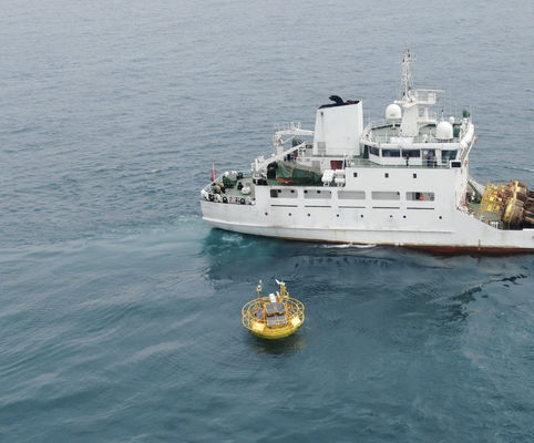
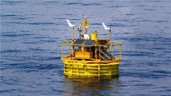
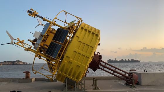
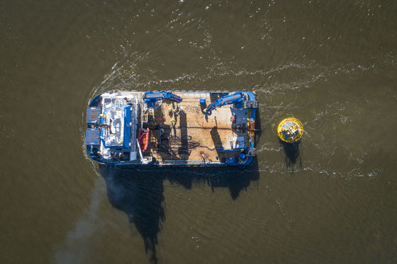
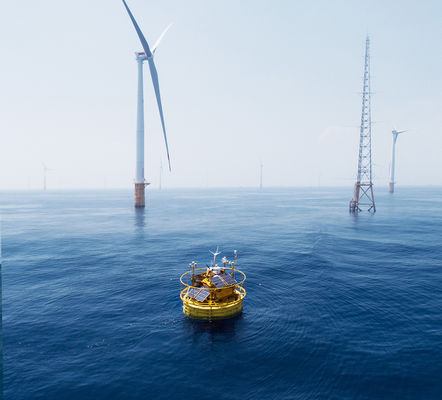
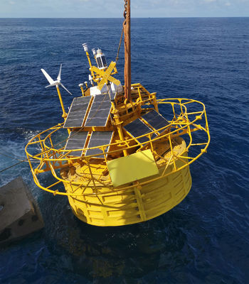
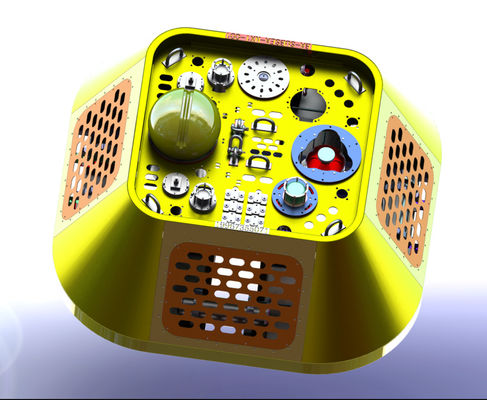
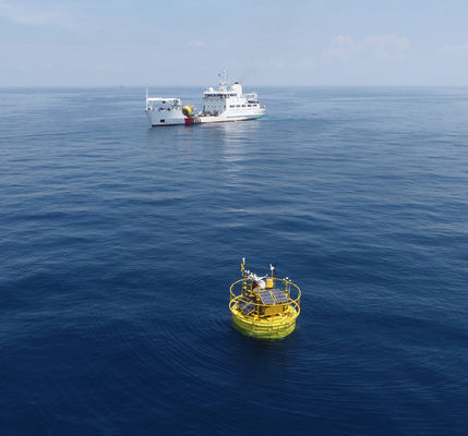
Floating LiDAR is a revolutionary product that offers innovative solutions for data collection and processing. It is a highly advanced technology for gathering information from any environment, such as on water, with accuracy and high precision. With sub-real-time data processing, the Floating LiDAR system is powered by solar panels, wind turbines, storage batteries, and fuel cells. It also provides a range of up to 10 km for data collection and storage. With local service support, this product can store data in various formats, including log, CSV, and TXT.
Floating LiDAR is a cost-effective, efficient, and reliable data collection and processing solution. Its compact size and lightweight design make it easy to install and operate in any environment, including extreme weather conditions. With its advanced features and capabilities, this product is ideal for any application, from basic data collection to more complex tasks. With Floating LiDAR, users can gather data quickly and accurately with minimal effort.
Floating LiDAR is the perfect choice for businesses, organizations, and individuals seeking a reliable and efficient data collection and processing solution. This product offers a wide range of features, including sub-real-time data processing, solar panel and wind turbine power supply, local service support, and up to 10 Km range. With its robust design and flexible features, Floating LiDAR is the perfect choice for data collection or processing needs.
Features:
- Product Name: BA-FLS-NX5
- Data Processing: Subreal-time
- Data Storage: Local Service
- Data Format: Log, CSV, TXT
- Power Supply: Solar Panel, Wind Turbine, Storage Battery, Fuel Cell
- Keywords: Floating LiDAR, Floating LiDAR, Floating LiDAR
Technical Parameters:
| Product Name |
BA-FLS-NX5 |
| Range |
Up To 10 Km |
| Data Format |
Log, CSV, TXT |
| Data Transmission |
Wireless, 4G, LAN, USB |
| Power Supply |
Solar Panel, Wind Turbine, Storage Battery, Fuel Cell |
| Weight |
15 Ton |
| Data Processing |
Subreal-time |
| Size |
Medium |
| Data Storage |
Local Service |
| Operating Temperature |
-30-50℃ |
Applications:
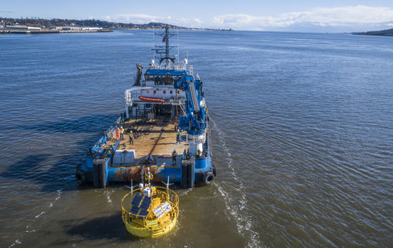
Blue Aspirations' BA-FLS-NX5 Floating LiDAR is an innovative LiDAR system designed for applications in areas that are difficult to reach with traditional LiDAR systems. The BA-FLS-NX5 can provide precise 3D data for various applications and be used in various environments. The BA-FLS-NX5 is powered by a solar panel, wind turbine, storage battery, or fuel cell and can transmit data wirelessly through 4G, LAN, or USB connections. It has a range of up to 10 km and provides sub-real-time data processing and storage capabilities.
The BA-FLS-NX5 can monitor coastal erosion and measure the depth of rivers and lakes. It can also be used for precision navigation, mapping of ocean areas, and planning and monitoring construction projects. Additionally, the Floating LiDAR system can monitor atmospheric conditions, such as wind speed and direction, and detect changes in the climate. The BA-FLS-NX5 is also suitable for military operations, enabling accurate and detailed surveillance of areas and objects.
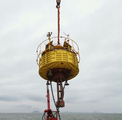
The BA-FLS-NX5 is a reliable and robust system designed to withstand harsh conditions. It is a cost-effective solution for various applications and ideal for those looking for a reliable floating LiDAR system.
Customization:
Blue Aspirations Floating LiDAR BA-FLS-NX5
Place of Origin: China
Power Supply: Solar Panel, Wind Turbine, Storage Battery, Fuel Cell
Data Storage: Local Service
Product Name: BA-FLS-NX5
Weight: 15 Ton
Data Format: Log, CSV, TXT
Our Blue Aspirations Floating LiDAR BA-FLS-NX5 is a reliable and versatile system for collecting and analyzing data from the surrounding environment. This product is powered by solar panels, wind turbines, storage batteries, and a fuel cell, making it a highly reliable and efficient system. The data collected is stored in local service and is available in Log, CSV, and TXT format. The product also weighs 15 Tons, making it highly portable and versatile.
Support and Services:
Floating LiDAR provides technical support and services to meet the needs of customers. Our team of experienced and knowledgeable technicians can assist you with installing, maintaining, and troubleshooting your Floating LiDAR system.
We provide comprehensive training to ensure that you are familiar with the operation and features of your LiDAR system. Our technical support staff is available by phone or email to answer your questions and provide assistance. We also offer software updates and upgrades for your system.
Our goal is to provide you with high customer service and satisfaction. We strive to ensure your LiDAR system operates to its full potential and meets your needs. We are committed to providing the best possible experience for our customers.

 Your message must be between 20-3,000 characters!