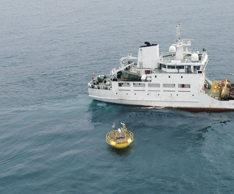
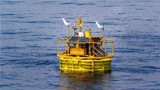
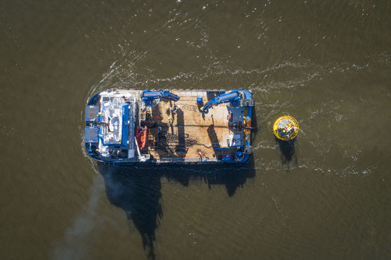
Meteorological Floating LiDAR Hydrologic Monitoring Buoys For Navigational Guides

1
MOQ
1300000-1800000USD
Price
Meteorological Floating LiDAR Hydrologic Monitoring Buoys For Navigational Guides
Features Gallery Product Description Request A Quote
Features
Specifications
Highlight:

meteorological Buoy

,

buoys for navigational guides

,

Hydrologic Monitoring Buoy

Basic Infomation
Place of Origin: China
Brand Name: Blue Aspirations
Certification: OWA Stage 2
Model Number: BA-FLS-NX5
Payment & Shipping Terms
Packaging Details: 3 Standard container
Delivery Time: 2-3month
Payment Terms: T/T
Supply Ability: 3 Unnits/Month Without pre validation.
Product Description

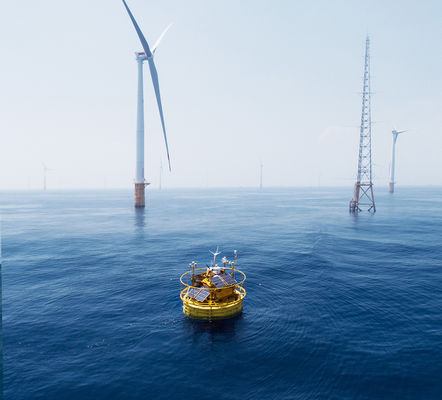
Floating LiDAR-Hydrological buoy

1. Floating Platform

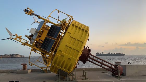
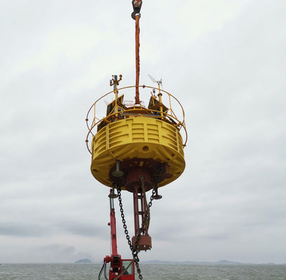
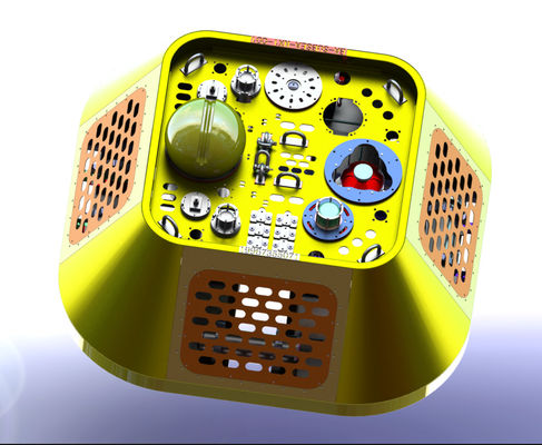
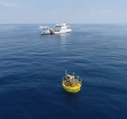
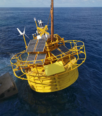
The floating platform is comprised of 4 foam blocks contained inside PE casings. The blocks are manufactured through rotational molding, and their modular structure allows the floating Lidar system to be easily disassembled for loading onto a truck or inside a container. This saves time and costs for domestic and international transportation.
 
Meteorological Floating LiDAR Hydrologic Monitoring Buoys For Navigational Guides 0
 

2. Design Principles

Reliability is the most important feature of any floating Lidar system and is a core tenet of Blue Aspirations’ design philosophy. Drawing on our team’s expertise in design principles from the telecommunications industry, the system emphasizes redundancy in its key components. The commercial model was also iteratively designed using simulations to model failure paths and eliminate single points of failure. Key examples of how these principles are embodied in the floating Lidar system include:

  • A minimum of two acquisition sources for wind and motion data;
  • A minimum of two of each data acquisition sensor link;
  • Two servers configured to seamlessly trade off between one another in the event of server downtime;
  • Redundancy in each power supply system to ensure negligible risk of power shortage;
  • Battery banks installed in separate cabinets with an auto-switch circuit designed to transfer load in the event of a single battery bank malfunction;
  • Data communication sub-system with at least two channels of up-link and down-link in the absence of 2/3/4G; and
  • Backup source for direction and motion measurements to maintain the supply of high-quality data, even in the event of significant damage to the system’s masts, antennas, primary GNSS-INS and compass sensors.

Meteorological Floating LiDAR Hydrologic Monitoring Buoys For Navigational Guides 1


3. Motion Compensation

Since the motion of the buoy affects LiDAR wind direction and wind speed measurements, Blue Aspirations’ system is equipped with a motion sensor to acquire high-resolution pitch and roll data, and heading and DGPS sensors to obtain accurate heading information. Our patented algorithm then uses a projection method to correct the LiDAR wind speed data to the appropriate horizontal plane. By calculating the LiDAR installation angle offset from the heading sensor’s true north, the system is likewise able to transform the collected wind direction data to the correct angle.


3. Technical Details

Modules Details
Buoy

-Diameter: 5m

-Height: 9m

-Weight: 14.5t

-Net Buoyancy: 10.5t

-Structure: multiple cabinets

-Materials: PE, carbon steel, stainless steel

Mooring System

-Water-depth: >5m

-Anchor: cement block and/or mooring anchor

-Mooring: one-point mooring

-Adjustable to suit site-specific requirements including deep water-depth

-Multiple mooring system is also available

Control System

-Industrial PLC

-or BA's embedded controller

LiDARs

-LiDARs: Dual LiDAR(default)

(Windcube offshore version; ZX 300M, Movelaser B300M)

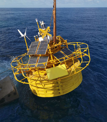
Power Supply

-Battery Capacity: total 60kwh in multiple groups;

-Wind Turbines: 2×350W;

-Solar Panels: 1600W, multiple groups;

- Fuel cells: 2x110W with 224L fuel(optional)

Navigation System

-AIS×1

-Radar reflector×2

-IALA-compliant navigation ligh1×-1

Supporting dual navigation light but Need to meet the requirement of local authority

Positioning System

-Directions: 0-360°

-Direction accuracy: 0.09° (2m baseline)

-Positioning accuracy: 0.5m (horizontal, SBAS mode)

Motion Sensors -GNSS-INS sensor×2 or GNSS-INS sensor×1 and MRU sensor×1
Communication Systems

-SAT Modules: Iridium SBD×1, other Broadband SAT data modules (optional);

-Mobile Networks: 2G/3G/4G×1; 2.4G/5G Wi-Fi×2; Local Ethernet connection

Data Acquisition

-Dual Industrial PCs

-Interfaces: serial×6, Ethernet×2

Hydrological sensors

(optional)

-Doppler current sensor

-Wave sensor and water depth sensor

-Water salinity and temperature sensor


Meteorological Floating LiDAR Hydrologic Monitoring Buoys For Navigational Guides 2

5. Summary of Validation

We would like to include in this document a summary of the reports from our clients or from third parties nominated by our clients that support our data accuracy and data availability claims.

A summary of the main results is provided below.

Client Project Name Buoy and LiDAR Model Reference Issuer of the report Time Main findings
Blue Aspirations

Carbon Trust

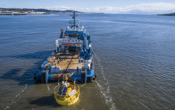
OWA Road map Stage 2 Verification (Dundee, Scotland)

BA-FLS-NX5,

ZX 300M x 1;

Windcube offshore V2 x1


Offshore

Met Mast

Inch Cape


Oldbaum Services from the UK

(3rd-party certifier ).

DNV will review the final report

2023.3 - 2023.9

Interim Stage 2 Assessment Report for Windcube:

Duration: 77days; System availability: 100%

Data availability: >99.2% for all measurement heights

Data accuracy(Wind speed):

>2m/s: R2 > 0.991, Slope: 0.995~1.001

4~16m/s: R2 > 0.985, Slope: 0.988~1.001

Data accuracy(Wind Direction):

91m: R2 >0.998, Slope: 1.003,

101m: R2 >0.998, Slope: 1.003,

111m:R2 >0.998, Slope: 1.003,

China Three Gorges

Yangjiang,

Guangdong

BA-FLS-NX5,

ZX 300M

Offshore

Met Mast

Blue

Aspirations

2021

Duration: 2 months; System availability: 100%

Data availability: >99.98% for all measurement heights

Data accuracy(Wind speed):

>2m/s: R2 > 0.9959, Slope: 0.9964~1.0096

4~16m/s: R2 > 0.9921, Slope: 0.9986~1.0122

Data accuracy(Wind Direction):

50m: R2 >0.9987, Slope: 1.0125, Offset:-1.9075

100m: R2 >0.9986, Slope: 1.0198, Offset:-1.4955

China Three Gorges

Yangjiang,

Guangdong

BA-FLS-NX5,

Molas B300M

Offshore

Met Mast

Shanghai

Institute

2022

Duration: 2 months; System availability: 100%

Data availability: >98.5% for all measurement heights

Data accuracy(Wind speed):

>2m/s: R2 > 0.99, Slope: 1.00~1.01

4~16m/s: R2 > 0.99, Slope: 1.00~1.02

Data accuracy(Wind Direction):

R2 > 0.97, Slope: 1.03, Offset: -1.3

Blue Aspirations

Prototype

validation,

Zhoushan, nearshore

BA-FLS-2.4,

ZX 300M

Fixed ZX

300M

DNVGL 2019

Duration: 1 month; System availability: 100%

Data availability: >97% for all measurement heights

Data accuracy(Wind speed):

>2m/s: R2 > 0.994, Slope: 0.994~1.003

Data accuracy(Wind Direction):

R2 > 0.999, Slope: 0.998-1.002,

Offset: -0.83~0.04

Huarun

Cangnan,

Zhejiang

BA-FLS-NX5,

ZX 300M

Offshore

Met Mast

Huarun 2020

Duration: 1 month; System availability: 100%

Data availability: >96.24% for all measurement heights except 120m (Note: 91.31%, several foggy days)

Data accuracy(Wind speed):

>2m/s : R2 > 0.9918, Slope: 0.9889~1.0283

4~16m/s: R2 > 0.9851, Slope: 0.9851~0.9938

Data accuracy(Wind Direction):

R2 > 0.9981, Slope: 0.9826~0.9961, Offset: -0.758~1.4559

Shanghai

Institute

Nanhui,

Shanghai

BA-FLS-NX5,

ZX 300M

Fixed

platform

ZX 300

Blue

Aspirations

2020

Duration: 2 months; System availability: 100%

Data availability: >99.7% for all measurement heights

Data accuracy(Wind speed, >2m/s and 4~16m/s): R2 > 0.97, Slope: 0.98~1.02

Note: the platform LiDAR has a fatal issue with wind direction thus Wind direction is not compared

Power

China

Shantou

BA4.1S,

ZX 300M

    2020

Duration: 2 months; System availability: 100%

Data availability: >99.0% for all measurement heights


Recommended Products
Get in touch with us
Tel : +86 18758287649
Characters Remaining(20/3000)